RSS Feed RSS Feed
Where is Pamukkale?
Visit of one of the Mother Nature’s phenomena “Pamukkale”, which translated into English means “Cotton Castle” .
Over thousand of years hot mineral waters had burst from the earth to run through the ancient city of Hieropolis before cascading down over a cliff. 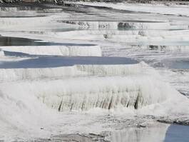 Pamukkale Geothermal Cascades Pamukkale Geothermal Cascades
These waters contained a high content of calcium which solidify into snowy white travertines: Water falls of white stone in laid with layer upon layer of small pools filled with the calcium rich warm mineral water.
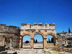 Gate of Domitian at Hierapolis Pamukkale, Turkey Gate of Domitian at Hierapolis Pamukkale, Turkey
The ancient city of Hieropolis was cure center, famous for the health giving properties of its mineral waters and hot springs.
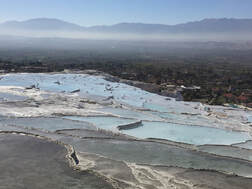
Founded in about 200 BC, it prospered under the Romans and later the Byzantines. 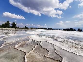 Pamukkale Calcium Terraces Turkey Pamukkale Calcium Terraces Turkey
The stunning white calcium pools, which cling to the side of a ridge, have long been one of the most famous picture postcard views of Turkey.
Pamukkale was formed when a spring with a high content of dissolved calcium bicarbonate cascaded over the edge of the cliff, which cooled and hardened leaving calcium deposits. This formed into natural pools, shelves and ridges, which tourists could plunge and splash in the warm water.
Hotels were springing up from the 1970s to cater for the large influx of tourists, and shortly afterwards UNESCO declared it a World Heritage Site.
But by the 1990s, this took its toll on the state of the calcium pools and restrictions were placed on these travertine terraces. Many hotels were knocked down, visitors are only allowed on major paths around the sites, and must remove footwear to stand on the calcium deposits. This seems to have been a successful move, as the water supply is now used for preservation and some of the damaged calcium deposits have been strengthened. RSS Feed
Where is Panionion?
HISTORY : The central part of the West Anatolia shore between İzmir and Bargylia Bays, with Samos [Sisam) and Chios [Sakız) Islands, form the region which is called lonia. Besides, this term is mostly used for a bigger part of West Anatolia with the islands around. The names of twelve islands which were informed by Heredotos are: at south, Milet, Myus and Priene; at the center, Ephesus, Kolophon, Teos and Lebedos; at north, Erythrai, Klazomenai, Phokaia, Samos and Chios Islands.
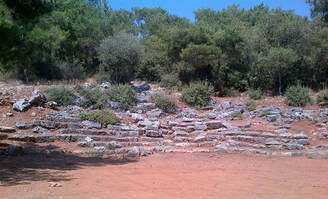
The twelve lon cities which also include Old Izmir city, formed a politically aimed union called Panionion. It is impossible to suppose that Panionion was founded later than the 9th century because Izmir joined the union in the early 8th century B.C. The Panionion Union gathered together at a sacred place imputed to Poseidon Heliconios, at Güzelçamlı region, at the of Mykale mountain.
During the digs in 1957-1958, G. Kleiner found a building that was to be an altar. Kleiner proved that this altar belongs to the late 6th century B.C. This building was formed as an 11 runged theatre, carved on the outside of the rock; and was used as the meeting place for the lonion city senators. Since the first day of the Panionion, a central organization was formed, vvhich provided the development of the lon cities. According to this organization lonians created one of the most brilliant cultures of the world history; they also extended their settlement and impression by political union.
The most brilliant period of lonion cities began at the second half of the 7th century, after the foundation of the colonies. It reached the top of its development during the golden age at 600-545 B.C. At this period, the cultural innovation of the Near East, passed through to centers. lonia of this period, guided the not only for positive sciences and philosophy, also for architecture and sculpture.
After the defeat of Lydian King Croisos against Acamonid King Cyros, Persian Commander Harpagos captured most of the West Anatolian cities [545 B.C). There was just one Ionian city-state to be totally free; this was Samos vvhich vvas governed by Tiran Polycrates.
Ploycrates was mudered in 522 B.c., by Persian Governor Oroites of Menderes Magnesia. From then, semi-free state Milet gained the leadership from Samos. In addition, Ionians couldn't oppose a state system formed due to the enforcement of tirans with the influence of Persians. So in 499 B.C. , the rebellion, which was managed by Milet, ended with destruction of Sardes. After a short time Persians realized their first attack by destroying 353 ships of the lonion navy in open sea of the small island of Lade. Today this place is a small hill surrounded by claylike soil brought by Menderes River. Persians, later, burned Milet city in 494 B.C.The attack of Athens and Eretria to Sardes with Ionians, caused the retortion of Persians by destructing Athena Acropol in 480 B.C. Inaddition, the next year, in 479 B. C, when Persians won their last victory in Plataea, Ionians defeated the Persian navy in Mykale, with the migrations from continental-Greek.So Ionian cities gaine their liberty again. Due to DELOS union formed at the same year, West Anatoliakept its liberty as an ally of Athens till 412 B.C. Until the era of Alexander the Great at the next century, lonion cities mostly stayed under Persian domination or control. At the Roman period, lonia gathered into Asia Province. During this period, lonion cities had brilliant days and became effective on the birth of Christianity and Byzantium art with the other cultural centers of Anatolia. RSS Feed
Davutlar Geothermal Spring SPA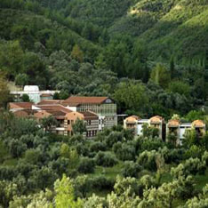
Davutlar Thermal Establishment is in Davutkoy which is 3 kms. distance to Davutlar Center.
In this establishment there are three 120 square meter size pools containing sulfur inside. Backround of the Thermal
The Course of River Menderes has a great underground mineral water resource on the both left and right side of the river which is created by the river starting with the 900 mts. altitude until reaching the Aegean Sea for thousands of years.
Germencik District, Bozkoy and Gumuskoy Districts has the most important Thermal Resources of the Area. Thermal Resource in Davutlar and Salavatlı thermal which is the west part of Sultanhisar is used by the local people in the region. This thermal water is used for
THERMAL CENTER IN DAVUTLAR
Indications :
*Total mineralization of the thermal is 6016,97 mg/Lt., *It has a mixed character thermal water with
*It is used as a collateral component for the treatments of diseases below *Under the control of the medical doctor, it is applied in form of bath application for
*Used as to add the finishing touches after soft tissue diseases such as
*Orthopedic operations *Mobilization work , after staying immobile because of a cerebral and nerve surgeries *For rehabilitation of cerebral palsy *Stress disordery, neurotony *Athletic injuries *Dermatological diseases such as psoriasis *Catarrhal problems and respiratory system *Since the water has fluoride inside, it can be drinkable but the resource is salty so that it is not recommended to drink. RSS Feed
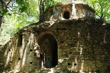
Where is Kursunlu Monastery from Kusadasi?
It is an impressive region where natural beauty and historical richness meet.
This part of Anatolia has been one of the religious centers as a result of intense Christian migration in the 8th century. Priests who escaped from the depression, built up churches and monasteries in this region where they would be able to hide away and worship. It is not known for sure where the name "Kursunlu Monastery" came from. It is supposed that it is a Byzantine form Orthodox monastery belonging to the 11th century. The reason of the height is known that its position prevented the attacks of Icon-worshipers and Heretics, it was also used to educate. In the monastery, there are a mess hall, warehouse, kitchen, monk rooms,clinic, chapel, necropolis (cemetery], monastery ramparts, rampart cellar and defence rooms. The main quality of the Chapel's ceiling is the frescoes. During the Iconoclastic period symbolist and geometrical motifs; at the second half of the 9th century, after the Iconoclastic period, religious events or people were shown on the frescoes. Fish, rooster and grape are the main religious symbols. On the frescoes, the pictures were made on a basin or wall. Frescoes are made freely through the ending of the ban on icon-making; also the religious unrestriction due to the domination of Seljuk State in the 12th century. The subjects were mostly from The Holy Bible and the life of Jesus Christ. Kursunlu Monastery served as a religious school and missionary. The Chapel is cross planned and has a dome-style. According to data from the sacred writings, St. Mary and St. John came to Ephesus in the year 42. This is told in the Bible written by St. John. According to the tradition, St. John wrote this Bible for Ephesus' people. It indicates the problems of Ephesus, the questions of the people and the answers to these questions. Mary, who let her apostles introduce Jesus to humanity was very fastidious on living in secret. So, Ephesus became the sacred religious center of Christianity. That is why Selcuk in Ephesus, Scala Nuova(Kusadasi) and their surroundings are very rich with churches and monasteries. It is an impressive region where natural beauty and historical richness meet. Location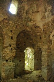
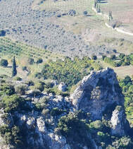
The monastery is located on 600 meters altitude.
The monastery captures the magnificent view of Davutlar-Kusadası and almost hides itself in the hillside. Especially in the spring; the region is just like a natural hospital where the birds sing, all tones of green color meet the blue sea, flowers smell like heaven, spring waters flow; and Kursunlu Monastery looks like watching Panionion [Guzelcamli), Davutlar, Kusadasi, Ephesus and Samos [Sisam Island) from far away. The monastery, which is right at the back of Dilek National Park is filled with zoological and botanic richness, waits to be discovered and to serve for tourism, on the Samsun Mountains. You feel like going up to Mother Mary's House at Ephesus while climbing to Kursunlu Monastery. Destination is the same, the road is the same and the view is more magnificent. RSS Feed
Previously it was called "Çanlı", Later two rulers came to the region mastering Circassians and Nomads.
One was Davut [David], the other one was Cafer [Jeffrey]. They earned their livings by stockbreeding. Davut set his people's tents to this place [Davutlar] and Cafer To Caferli. In time they formed buildings where Davutlar and Caferli of today existed. Davutlar, one of the villages of those times became a subdistrict in 1922. RSS Feed
Today, underground caves deal with different sciences like archeology and medicine.
Because, caves give us information of the past. They seem like a mysterious world enlightening us with underground movements, fossils, stalagmites and stalactites, plant and animal world of underground, geological knowledge, some chemical and physical knowledge hydrological and hydrogeological knowledges. Underground caves are like curing hospitals and laboratories because of the gases like carbon dioxide, oxygen, nitrogen and sulphur. 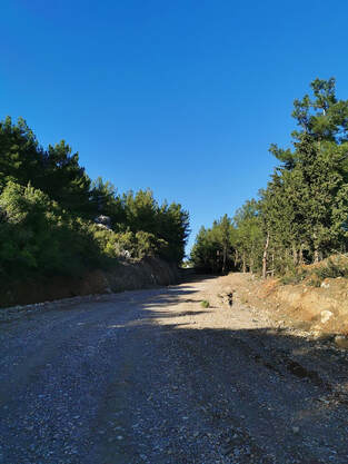 Road leading up to the Cave Road leading up to the Cave
Also, mineral waters are very important for human health.
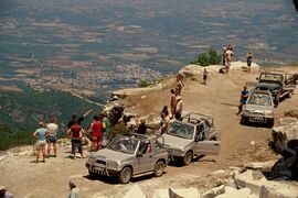
In the caves, it is possible to see and use the curing waters which cannot reach the surface. For reaching Aslanlı Cave at Kirazlı Village, Yayla region, you have to leave the car at Derebogazı part of Kusadası-Kirazlı road and follow the 3 kms. jang soil-road on the left, on foot for half an hour; or for ten minutes by another kind of vehicle. 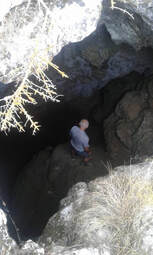 Entry way to Yaren Cave Kusadasi Kirazli Entry way to Yaren Cave Kusadasi Kirazli
It is a partly perpendicular, partly horizontal type of cave, where the inhabitants know but cannot enter. The first examination was made by L. Nazik and N.Güldalı from İzmir project team of Mine Checking and Research [MTA] General Directorate, in December 1985.
GEOLOCICAL & GEOMORPHOLOGICAL STRUCTURE 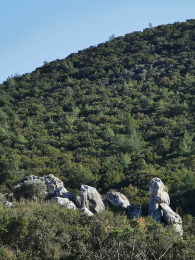 Rock Formations around Yaren Cave Rock Formations around Yaren Cave
It is a cave that developed inside of mezozoic age Dolomithic marbles on a big surface.
After a 6 m. long downward slope, the cave descends to the west with 26° angle, through a line which has east-west direction. After 40 meters , it enlarges and looks like a slope-floor hall. This part of the cave is covered with either muddy soil or big rock blocks which have fallen from the ceiling. Also on this stack, stalagmites and stalactites have formed, and the wells were covered with curtains and flag-travertines. 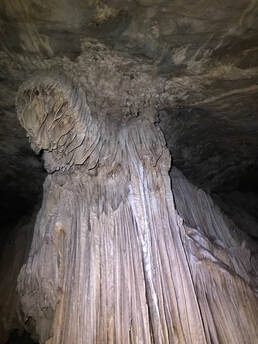 Inside Yaren Cave Inside Yaren Cave
It is called "Aslanlı (lion)Cave" because of the lion-like stalagmite. Hydrologically, it is a dry cave. The temperature of the cave is about 18-20 °C.
A large bat colony and other small animals have been seen here. The cave is 110 m. long, 36 m. deep, and it is known as "Yaren [Friend] Cave" inhabitants. Curing of asthma and chronic bronchitis with carbon dioxide, oxygen, nitrogen and radioactiveness of its hot and moist air, are possible only after touristic planning. 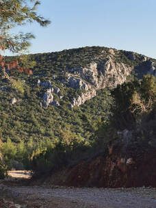 Road to Yaren Cave Road to Yaren Cave
Though the end of 1994, the soil pathway to Yaren Cave was enlarged for large vehicles.
Inhabitants of Kirazlı, due to this situation, await the extension of the cave mouth mounting of a stairway, concrete path and stairway and illumination for sanitary tourism. RSS Feed
In 1427 three immigrant shepherd families, Eseogulları, Efendiogulları and Köseogulları came to Kirazlı region and established their camps on these fruitful and green lands.
At those times,while establishing the village lots of water pipes and cubes were found. So the village village was called KÜPLÜCE , Later on, because of its fruitfulness, the name was changed to AKÇAOVA. There are almost every kind of trees on the plain such as cherry, sour-cherry, plum, apricot, grapes, fig, olive, nuts, pomegranate, quince, walnut and pine. Also agricultural products such as tobacco, sesame, corn, chickpeas and beans are grown. The good produce of sour cherry and cherry and giving the importance to these fruits, caused the name of the village. So, once more the village was renamed as KIRAZLI. Parallel to agriculture, stock breeding was developed; animals increased such as cow, sheep, goat, etc. Suitable to name "KIRAZLI (CHERRY LAND) Cherry Festivals began to be held from 1975; during these festivals beauty contests were organized, and cherry production was inspired. Recently Cherry Festivals are delayed because of economical problems for now. History of Kirazli
In Izmir, there were Italians making up about 5000-6000 people.
The allied nations showed Izmir under Italian territory at St.Jean de Maurienne Conferance in 1917. There was a police station beside the house of Muhtar Hüseyin Uluçay. This police station was used as a station by Roums previously. Between 1914-1917, Greeks lived here but they had to leave on September 07th, 1922. In 1917, Italians were serving as horsemen-patrols; on the other hand native Roums, Italians and Greeks were going to the Monastery for prayers which was at Degirmendere region, where the water sources of today's Kusadasi area. In 1922, with the beginning of independence movements, Italians and Greeks began to escape through Çamlık. While escaping, they were taking some of the inhabitants of Kirazlı Village with them, and killing who refused. At last, due to the entrance of Turkish cavalry men to the city without an important opposition in September, 7th 1922, the Turkish Flag began to be waved over. The Roum police station became Turkish station from then on. At the same time, the victorious commander of Turkish army, Gazi Mustafa Kemal Pasa arrived in Izmir with the other Turkish commanders, Fevzi Pasa, Ismet Pasa and Nurettin Pasa. During these years, there were 50 or 60 houses in Kirazlı; and the population was about 300. The Mosque of Kirazlı Village was restored in 1954, and today is still in use. It is supposed that it is 100 years old. Degirmendere region is pretty rich for underground water resources. District of Kusadası gets a very important part of its water from this region. Kırk Ayak (Forty Foot) Stairs which are at Asar Altı region are at Yayla Köyü side and keep the main walls of 1st or 2nd century Roman period observation castle. Kirazlı, which is the region of tombs, and caves, has the true pride of tourism for belief tourism, cave tourism, hunting tourism, horse-back riding and tracking tourism to native and foreign tourists. RSS Feed
Where is Caravansarai?
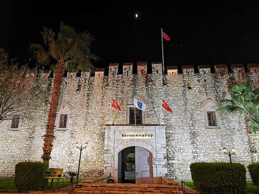 Kervansaray Kusadasi, Turkey Kervansaray Kusadasi, Turkey
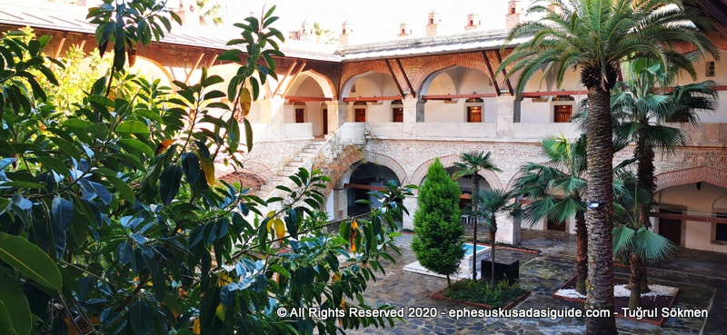
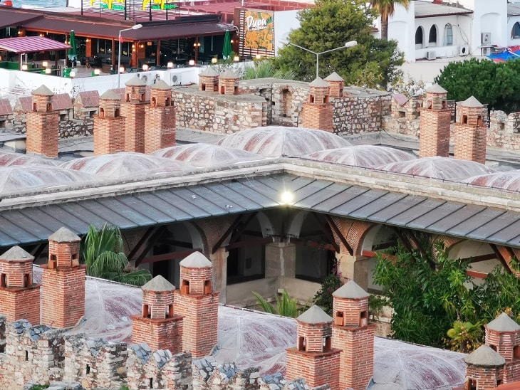
Okuz Mehmet Pasa Caravanserai is the principal of Ottoman architecture in Kusadasi city, was built by the man of the same name, who was the vizier during the reigns of Sultan Ahmet 1st and Osman 2nd in the 17th Century. The building is 400 years old.
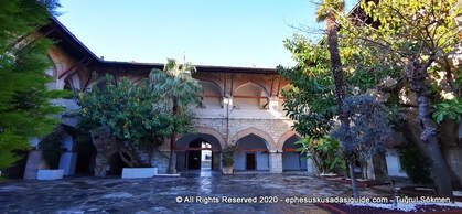 The Courtyard of Kervansaray (Caravansarai) in Kusadasi The Courtyard of Kervansaray (Caravansarai) in Kusadasi
As the visitors leave in their vehicles for Private Tours of Ephesus from Kusadasi Port they would see Caravansarai when they take the first left turn. Even on foot, when cruisers come our from the Port Premises, the Stone structure in the distance shows itself and inviting visitors to come and see it's peaceful courtyard.
Before Kusadasi (a.k.a Scala Nova - The New Port) was founded in the Late 12th century, Ancient Ephesus was the main trade center so Ephesus carried out the role as the Largest Port of the region.
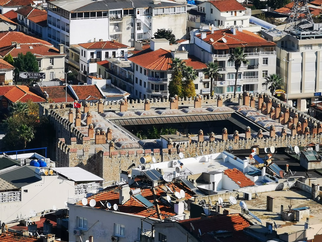
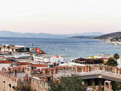 View of Kusadasi Port & Gulf over Caravansarai View of Kusadasi Port & Gulf over Caravansarai
Caravansarai buildings were built as almost Castle-like structure for defence and safety. They were not only trade centers but also offered safe accommodation for the merchants and their camels and horses. Also they functioned as storage for the merchandise.
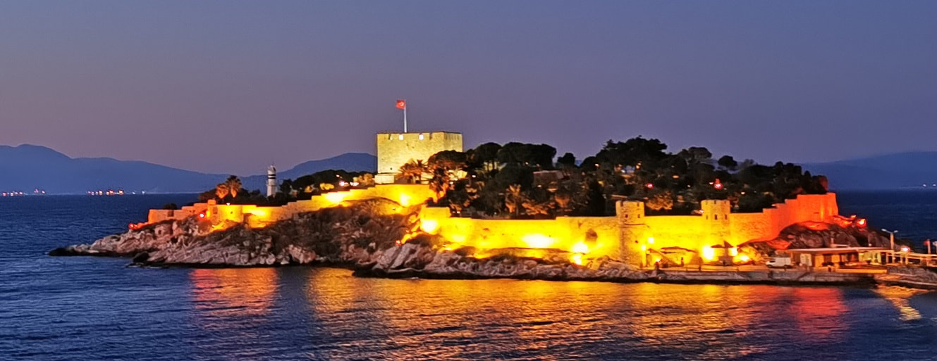
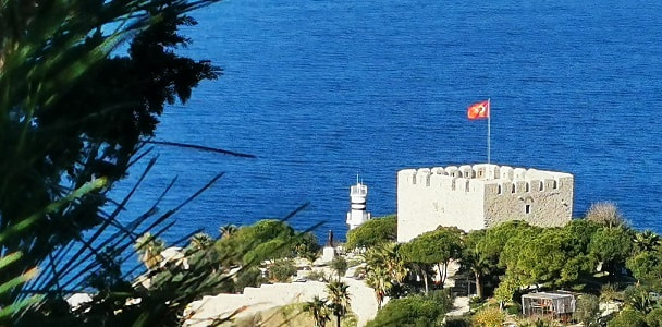
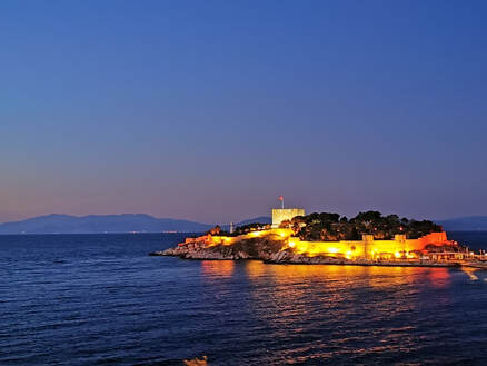
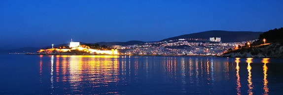
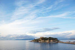
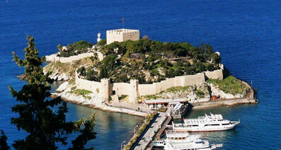 Pigeon Island (Güvercinada) Castle Kusadasi, Turkey Pigeon Island (Güvercinada) Castle Kusadasi, Turkey
This tiny island off the west coast of the town is just a few hundred meters from the mainland of Kusadasi, and connected by walkway.
It contains a fortress, which was constructed by the Ottomans and restored and strengthened in 1834.
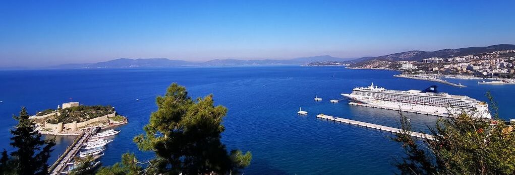
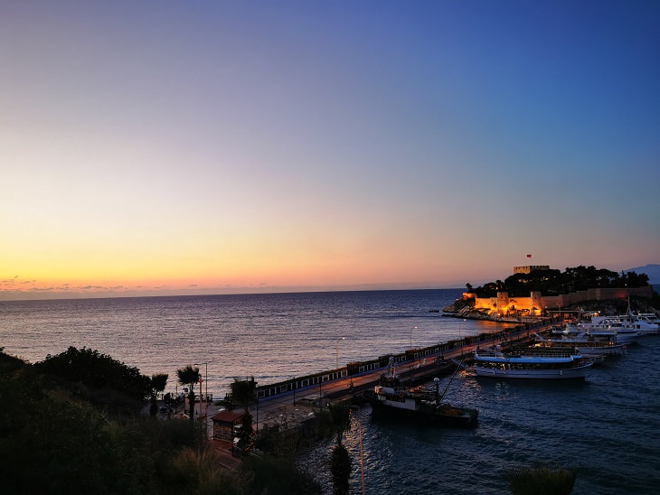
Panorama of Pigeon Island and Kusadasi Cruise Port
When Cruise Ships dock in Kusadasi Port, they actually become neighbors with the Pigeon Island for a day. It accompanies the Cruisers by giving them a great view if they prefer not go to Ephesus Sightseeing Tours and stay in their rooms. 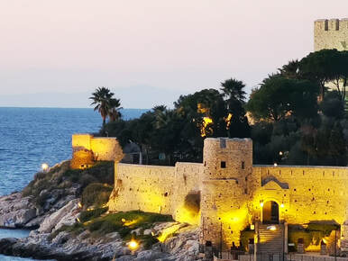 Pigeon Island, Kusadasi (Ephesus) Turkey Pigeon Island, Kusadasi (Ephesus) Turkey
Kusadasi was an important defensive port along the Ottoman Aegean coast, and the fortress helped prevent attacks coming from the islands.
It is now a relaxing place with landscaped terraces and several tea houses and snack bars.
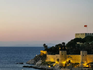 Guvercinada (Pigeon Island) Castle Guvercinada (Pigeon Island) Castle
In the fortress section where the Turkish Flag is, the Citadel has a Watchtower, to day it is used as an exhibition area for crafts and a Whale Skaleton.
In the outdoor courtyard of the Citadel there is a selection of various species of plants and Trees forming a small botany garden. In the hot summer days the vegetation and the breeze gives a nice feeling to the visitors.
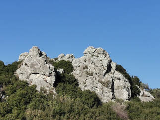
Almost every little county has it's Citadel in the Agean region. In Ephesus, there is Ayasuluk Hill known as Selcuk Hill.
On my ephesus tours I also mention about Ayasuluk Hill being near the water once the siltation had not affected the geology of Ephesus area. But this picture might give us an idea how Ayasuluk Hill of Ephesus looked once.
 Kusadasi Panorama with Pigeon Island Kusadasi Panorama with Pigeon Island
Pigeon Island and It's Citadel is known as the symbol of Kusadasi town, not only that but also a completion of Kusadasi's Vista.
 Today, Kusadasi is one of Turkey’ s most sophisticated holiday centers; a perfect place for vacation with its sandy beaches and glassy water. The contrast of the lively holiday life with the quietness of ancient ruins create the special atmosphere of the city. Early Kusadasi HistoryThe early settlements in Kusadasi is by the Lelegians and Carians who moved from the central Anatolia around the year of 3000 BC. They were the founders of a colony on the skirts of Pilav Mountain in Kusadasi, and founded the cities Ania and Melia. Mild climate allowed the inhabitants to grow essential products such as olive, grape and figs for extracting oil or making wine and sweets on the fertile lands around the city. Ancient Greek SettlementsIn the 10th century BC “12 Ionian Cities” – Samos, Khios, Miletos, Priene, Ephesus, Teos, Erythrai, Priene, Klazonemi, Lebedos, Phokaia, Colophon, Smyrna, were established and reputed for the most developed cities of that age. Asthe annual meeting place of the Ionian League, Panionian, was founded around Kusadasi; the cities of Phygale, Marathesion and Neopolis were established within the borders of the city. During the period, the ports of Phygale and Neopolis were not busy and necessary, as they were close to the famous trading centers and ports, Miletos and Ephesus. Persian RuleThe city was invaded by Persians around the year of 546 BC. In 200 BC Kusadasi and its environs were dominated by the Roman Empire, and with the division of the Roman Empire, became a state of Byzantine. As the changes in climate caused serious earthquakes and changed the route of Caystros River, Ephesus was mostly destroyed and lost its prior importance and prosperity. The result had forced Byzantines to search for a new port and a new road that would be suitable for trading. The area around Neopolis was found convenient by the Greek, Jewish, and Armenian merchants as a port in place of the port of Ephesus. “Scala Nova” was the name of this new port which added a new trading center to the prior historical cities such as Ania, Melia, Phygale and Neopolis, that have created the early foundations of today’s Kusadasi. By the coming of the 15th century, “Scala Nova” was under the domination of the Venetian and Genoese sailors and traders who established consulates here. Turkish EraThe Turkish domination in the area entered upon the invasion of Seljukian Kilic Arslan the 2nd. The advantageous position of Kusadasi as its being at the end of the important trade roads such as Silk Road – once held by Ephesus, influenced the development of the city in trading, positively. Kusadasi began to be ruled by the Ottoman Empire after the invasion of Sultan Mehmet Celebi in the year of 1413. During the reign of Ottomans, Kusadasi was introduced to glorious structures, giving a new look to its former spectacular view. World War 1After the First World War, Kusadasi was invaded by the Greeks (1919).
The city won a long struggle for in 1922 and became a part of Turkish Republic. Izmir was the capital of Kusadasi until 1954. Then the capital was changed to Aydin and the city of Kusadasi has shown a good deal of development, especially in tourism. |
AuthorWrite something about yourself. No need to be fancy, just an overview. ArchivesCategories |